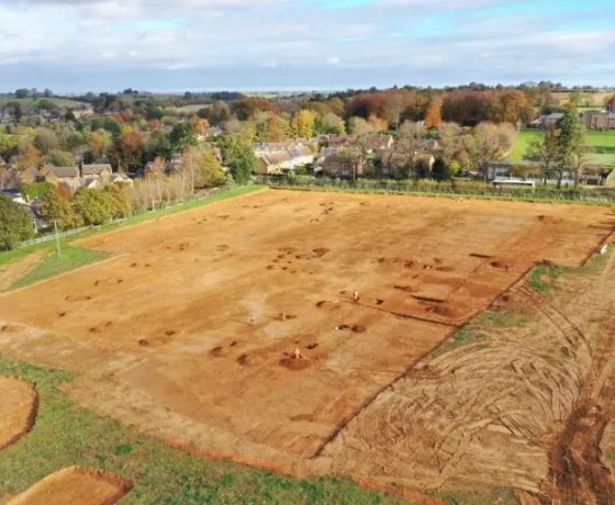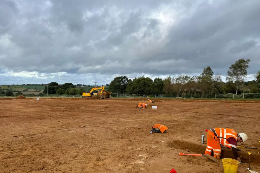
Despite the weather taking a turn for the cold and wet, progress on site has been fantastic. The whole of the excavation area is now open and we've started to get a real handle on the exposed remains.
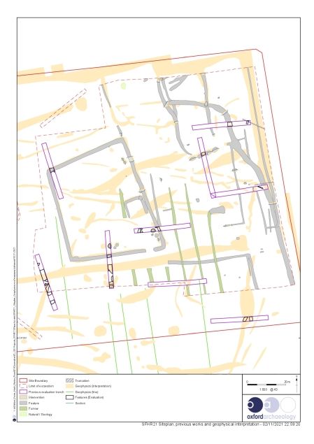
Below you can see a plan of the site (click the image for a larger version). The plan shows the archaeological features we have exposed in grey and the result of the geophysical survey in yellow. As you can see there are significantly more geophysical anomalies than archaeological features, these represent variation in the geology which aren't the result of human action and are of no archaeological interest.
The main feature on the site is a sub-rectangular enclosure that can be seen in the centre left of the plan. The enclosure encompasses an area roughly 55m by 45m and is defined by a continuous ditch with a single entrance in the south-east corner. The ditch itself has a fairly steep profile and measures roughly 1m deep. The material excavated from the ditch would have been piled up as a bank on the inside of this. As with sites like Maiden Castle and other hillforts this is done to accentuate the ditch and make it a more challenging boundary to cross, I should say that the enclosure at the site in Sibford Ferris is some what less imposing than those at Maiden Castle.
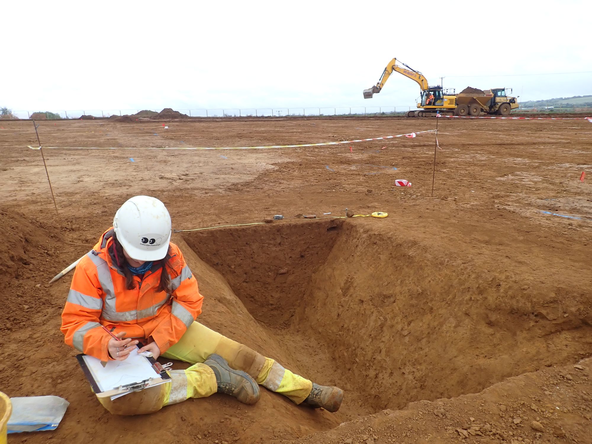
Recording the enclosure ditch.
Along with sherds of Iron Age pottery, we have recovered loom weights which are associated with textile production, telling us that this was occurring on site. When hung from the bottom of threads on a loom they create tension enabling the user to weave between the treads to create textiles. The loom weight we've recovered is made from fired clay with a central hole through which the thread could be tied. Unfortunately, it is not complete and only half of the weight has been recovered, most probably why it was discarded into the ditch.
We have also found fragments of daub, associated with clay structures such as ovens, and animal bone. Artefactual evidence like this suggest the enclosure is associated with settlement activity. Iron Age dwellings, or round houses, are constructed using wooden post and wattle and daub. They tend to survive in the archaeological record as post-holes in the ground, but unfortunately no such evidence has been identified within our enclosure. It is likely that such evidence has been lost to modern ploughing or natural erosion.
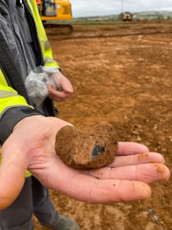
Fired clay loom weight - fresh from the ground.
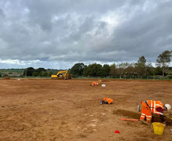
We do have several large pits surviving within the enclosure, often located near the ditch itself (these can be seen along the southern and eastern edges of the enclosure, and in the south-east corner near the entrance). As with the pits discussed in the last update, these would have been used for storage and the discarding of waste. In the base of the one of pits we found a charcoal rich deposits which is likely to be the remains from the use of an oven or from a fire. Deposits such as these are excellent for providing crucial environmental evidence. Assessment of the charcoal pieces will help us establish which species of trees were local to the site during the Iron Age. Hopefully we will also recover charred seeds and grains (charring is great for aiding preservation) which can help shed light on the diet and food sources. To recover these material we retain a sample of soil which processed at our office but this won't be done until we are off site. Another key indicator of diet is the recovery of animal bone. So far from the site we have evidence for sheep / goat and possibly cattle. Due to the acidity of the soil, bone preservation is poor and only the harder, more durable, teeth survive.
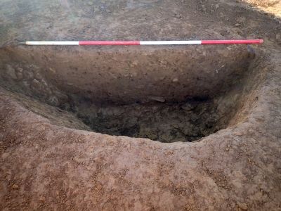
Charcoal rich fill visible as a darker band in the base of the pit.
Outside of the main enclosure we have a number of other pits and a series of small enclosures located in the north-east corner of the site. These enclosure are much smaller, not only in area but the ditches that define them are considerably smaller, most measuring less than 0.5m deep. We have recovered significantly less finds from these ditches and are currently interpreting them as stock enclosures.
We only have a couple of week left on site and over this time we will continue to investigate the remains exposed to ensure we have a comprehensive understanding of the activity within the site. This week we are having the site photographed using a drone and will be sure to share these picture with you next week.
Other posts in this collection
Read our latest posts about the archaeological investigations at Sibford Ferris.