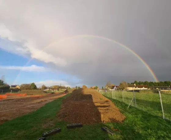
In 2022, Oxford Archaeology excavated the site of a proposed children’s home on the outskirts of the West Oxfordshire village of Aston.
Documents indicate that Aston was founded by the 10th century AD, but little else is known about the subsequent origins and development of the village. Our excavation will shed light on medieval Aston before the time of the Black Death, from the mid-11th century to the mid-13th century AD.
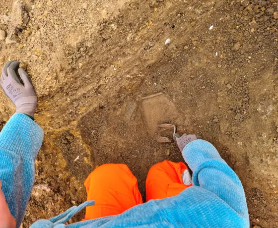
Although work on site is now finished, the post-excavation work continues as we start to process our soil samples and look at the finds in further detail.
Why are we digging here?
New developments have to be assessed for the impact on any archaeology as part of the planning process and developers are responsible for funding archaeological surveys and any measures that may be required to record or preserve discovered remains. In this case Oxford Archaeology (OA) has been commissioned by Beard Construction, on behalf of the developer, Oxfordshire County Council, to carry out an excavation on the site of a new children’s home on Back Lane in Aston. The excavation was required by the local planning authority as a condition of planning permission. The scope of the excavation has been agreed with the Oxfordshire Planning Archaeologist, who is responsible for monitoring developer-funded archaeological work in the county.
How do we know what archaeology is here?
During the planning process we looked at a wide range of evidence to give us clues as to what archaeology would be found here including:
- The Oxfordshire Historic Environment Record, a database of known sites and monuments in the county.
- Historic maps, going back in this case to the 18th century.
- Aerial photographs which can show cropmarks of ancient sites, particularly during very dry weather.
- Lidar data is a detailed map of surface topography covering much of Britain which has been gathered by the Environment Agency in recent decades and made publicly available. Lidar data can show up archaeological earthworks in great detail. Aston has extensive areas of permanent pastureland where ancient features survive as hump and bumps in the present ground surface.
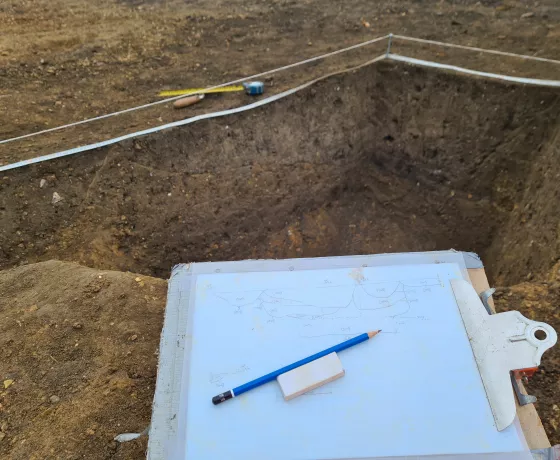
- Two trial trenches were dug on the site, which produced evidence for medieval settlement, in the form of pits and ditches containing medieval pottery.
What previous archaeological investigations have taken place in Aston?
Apart from the trial trenches OA carried out on the site there have been seven recorded archaeological investigations within the Aston area. These have recorded a range of Roman, medieval and post-medieval remains. The evidence is summarised by period in our timeline.
What do we hope to learn from the archaeological excavation?
What are the origins and nature of nucleated village settlement in the medieval period? Documentary evidence suggests that Aston may have been founded in the 10th century. This excavation provides a good opportunity for developing our understanding of how Aston developed during this formative period.
How were villages impacted by the demographic disasters of the 14th century?
The 14th century saw the reversal of centuries of demographic growth as a series of disasters including famines and epidemics caused population levels to plummet across Europe. In places such as England, recovery did not take place for more than 200 years. Any further evidence of this shrinkage or shifting in the settlement pattern will be useful in understanding the broader pattern of village shrinkage during this period.
What dietary evidence is there and what can it tell us?
The environmental (plant and animal) remains on site are known to be well-preserved and could provide a valuable resource in looking at variations in diet during this period. These could reflect availability but may also variations in social status, which could aid our understanding of medieval
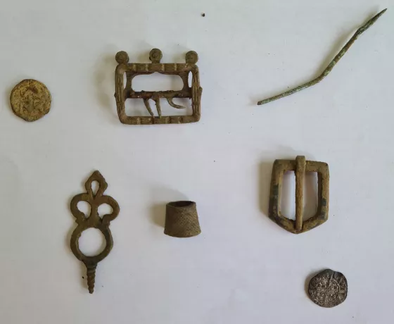
Our finds...
-
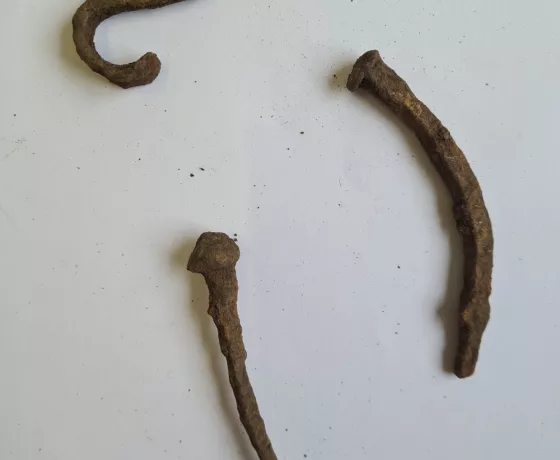 A selection of handmade nails
 -
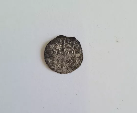 Edward I silver coin
 -
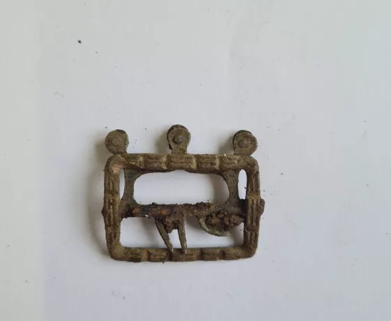 A tudor shoe buckle
 -
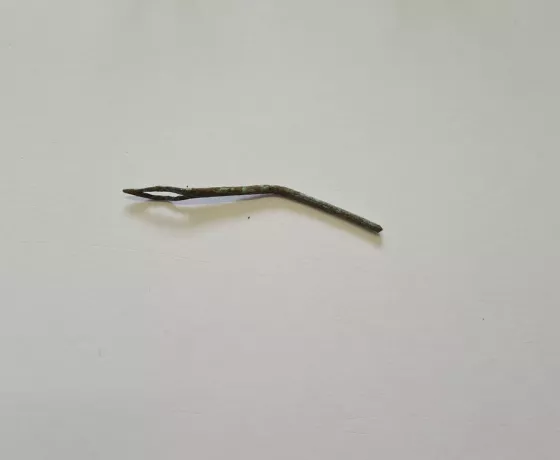 A copper alloy needle
 -
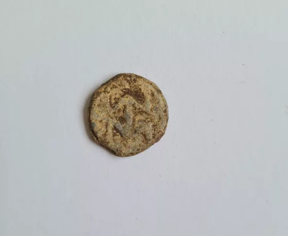 This is a lead farmer's token you might just be able to make out some initials